Have Questions? Contact Us!
Find out the answers to your questions by contacting us. We look forward to hearing from you!
How to Get The Best Aerial Images- RC Quadcopter Parts
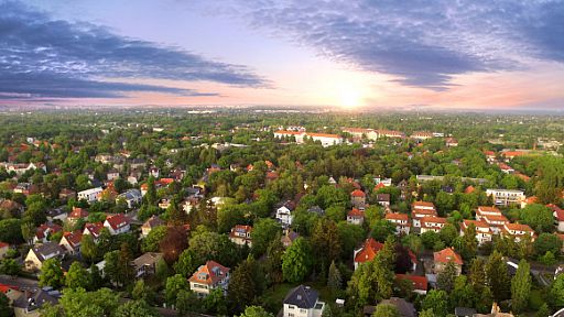

There has been a great revolution in the era of aerial photography over last few years. It is one of the best techniques to get pictures of the ground from high altitude. The balloonist Gaspard Felix Tournachon has started this type of photography business in the mid-19th century in France. It was initially used for capturing all kinds of motion picture cameras while mounting them on aircraft, especially for the army and security purposes. Aerial Imaging method has been proved very useful in fetching bird's eye view to places that are hard to reach and amazing to see.
This kind of photography solves variety of purposes and applications. This photography is quite practical for imaging maps but with a systematic approach. Since digital cameras are generally available for the normal consumer, a lot of people take such pictures. Topographic maps would be really tough to create without such photographs. These applications aren't new, but the innovation now utilized in the processing softwares like Geographic Information Systems. Even Real estate developers and brokers provide their potential clients a true view of property features using aerial cinematography.
Aerial cinematography has achieved new heights with remote camera (RC) capabilities. These RCs can fly through narrow areas, like natural or man-made barriers at high or low altitudes to take pictures or record video. Instead of endangering photographer or making him struggle to find the right angle from restricted landing areas, various RC Quadcopter parts and devices are now used. RCs may weigh about 10 pounds which enables it to fly different camera models. Up-close shots are also achievable with RCs when standard helicopter filming would be dangerous, such as closeness to buildings or wires. Using remote flying capability is less expensive than manned aircraft, which is practical for production corporations with low budgets.
Other ways of acquiring aerial photographs are using satellites, balloons, helicopters, kites, aeroplane and radio controlled aircraft. All these methods have their pros and cons and sometimes entirely depend upon the budget, data required and in most cases, the weather conditions. With aerial mapping becoming so popular now, the technology is improving so that the images are becoming ever clearer and the details more visible. There are also companies providing services to aerial photographs to be retrieved within just a few minutes and also combine them with other data to generate very accurate information. The technology has advanced to a great extent and can be used to produce the images in a very short period of time and this is what makes it so eye-catching to the people who make use of such services. As time has passed everything is becoming better and more developed with the result that progress is being make to produce really accurate images with more updated information than ever before.
Aerial video is turning into the alternative option to this kind of cinematography, since meta data can be inserted in the video using the GPS (or the Global Positioning System). This would only exhibit that technology and science may be going beyond the field of this type of photography into something more refined state. The complexity of the functioning is quite good due to the advancement made in the area of design and appearance of the cameras.
Be the First to Post on this Entry
There hasn't been any users whom have commented on this entry yet.Be the first one!